| A Little Bit About Skunk Bay Weather |
| This public service site has been in existence since 2006. It is privately held by Greg Johnson and self-funded along with the support of donations, advertising, consulting work and logo gear sales. I am active on Twitter: https://twitter.com/Skunkbayweather and Facebook: https://www.facebook.com/skunkbay.weather . I share much of the content from Facebook and Twitter posts on the SBW “Blog”. The link to this is on the SBW site in the upper left hand corner. I am not a meteorologist. However, I quote forecasts from a variety of sources and sometimes add a little color commentary about our local micro-climate. My real passion is showing what "actually" happened through photography. This provides content for us all to learn from. Purpose and intention: • Provide current and pertinent information about the weather. • Provide access to local services through website links. • Provide a one stop shop to a wide variety of popular sites related to weather, astronomy, sports and other public services. • Share the beauty of nature through a variety of photographic technologies. • Provide a forum where we can all learn together. • And most of all... Have some fun….. |
| Weather Station: The weather station is a Davis Vantage Pro2. There are two temperature sensors installed. One is on the water side and the other is installed further back on the property and is protected from the marine influence. Temperatures can vary up to 15 degrees between the two. During the summer when we have cool north winds off the water, the water-side temperature will be much cooler. During winter months, the water can actually warm the cold air and this results in warmer water-side temps. The software is Virtual Weather Station. The anemometer is on a 30 foot pole that is mounted on the ridge of the single story side of the house. This puts it at about 45 feet above ground. The closest trees are to the west about 150 feet away. |
| Cameras: Currently there are several active cams. • The primary cams are the 3 at the top of the site. These are Olympus SP500 digital cameras. They are named Cam1, Cam2 and Cam3. The software is Sebectec. They run 24/7/52 and take a picture every 20 seconds. This results in about 3,500 images per day per camera for a total of 10,500. A fresh image is uploaded every 2 minutes. A time lapse of the previous 3 hours is uploaded every hour. At midnight every night, a time lapse is uploaded of the full previous day. • There is a dedicated night cam that runs only on clear nights. It is a Canon T5 Rebel DSLR and provides nice images for Northern Lights, Meteors, Lightning or anything else that happens at night. I do ad hoc time lapses and images from this camera. The software is IPTimelapse. • Periodically, I will use a Mavic Pro drone for aerial photography. |
| This site shares data with: • MarineTraffic.com (Station #2312) • CWOP (Utilized By Many Organizations Including NWS, NOAA and UW) • Weather Underground • CoCoRaHS • Northwest Weather Network • WeatherForYou Content from this site has been used by: Good Morning America, Huffington Post, Weather Channel, WeatherNationTV, Cliff Mass's Blog, Scott Sistek's blog and all of the local Seattle networks: KOMO, KING, KIRO and KCPQ |
| Honors: In 2017, this site was honored with front page articles in both the Seattle Times and the Kitsap Sun. Seattle Times Article Kitsap Sun Article |
| The image below shows how the cams are oriented. |
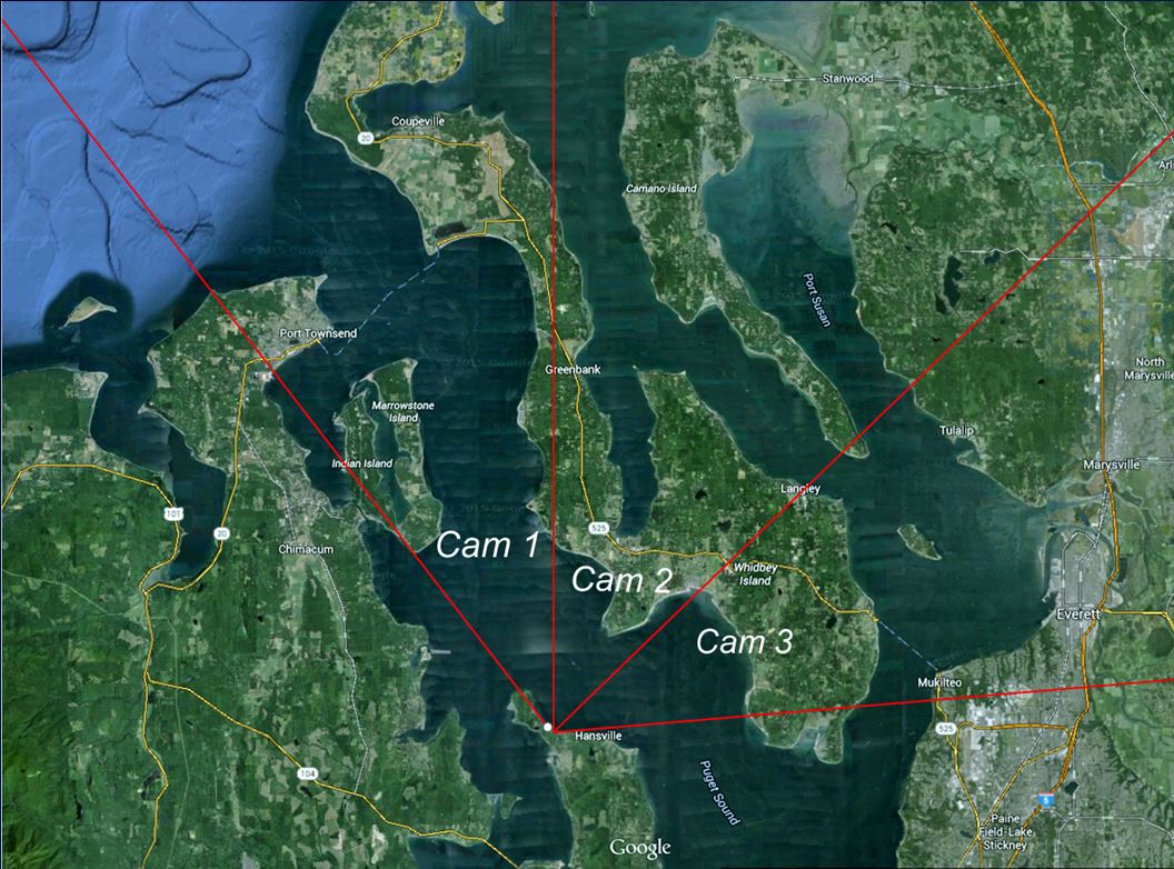 |
| Some Sample Images |
| Aerial Photo of Skunk Bay and Foulweather Bluff |
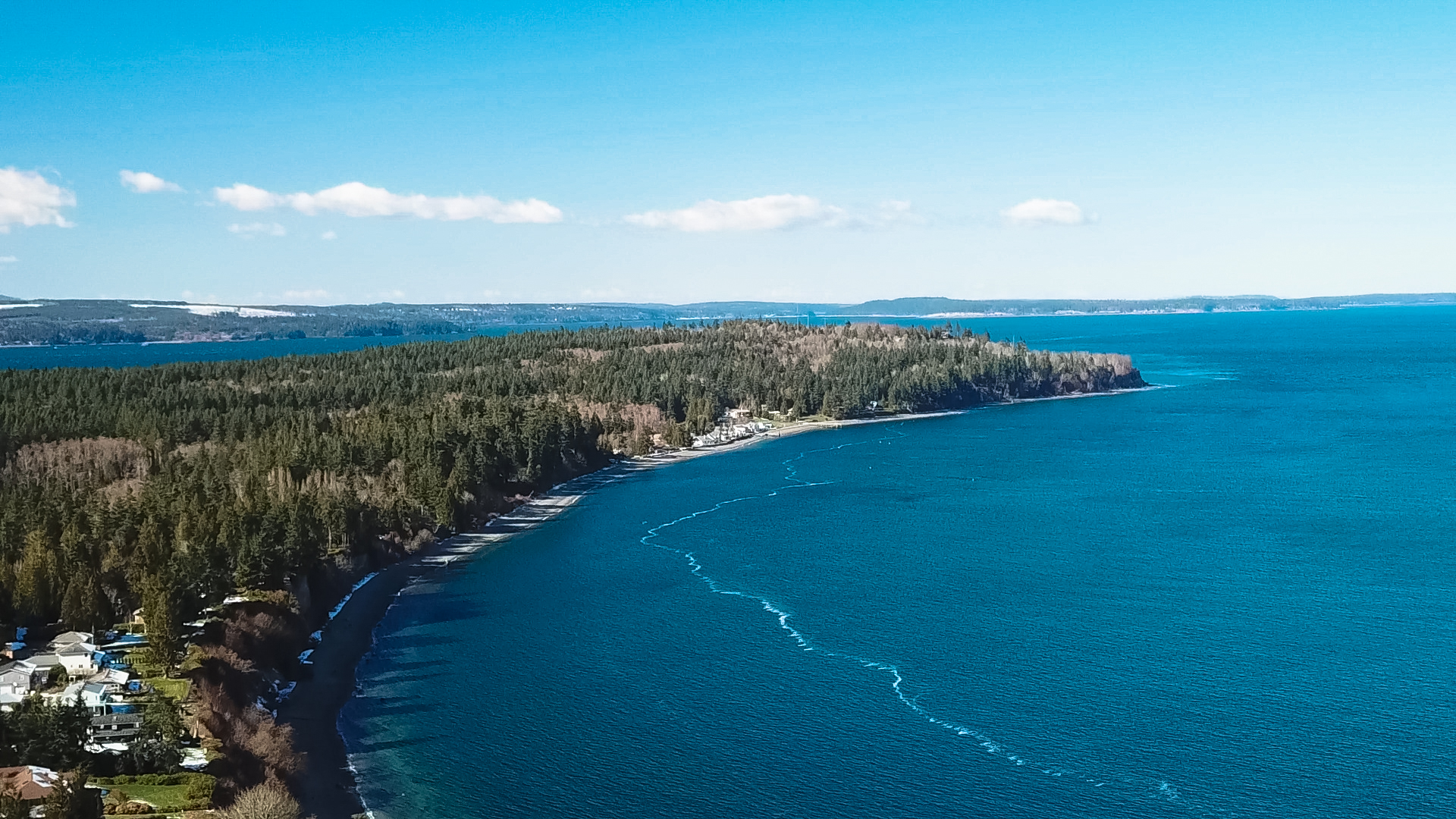 |
| Aurora Borealis |
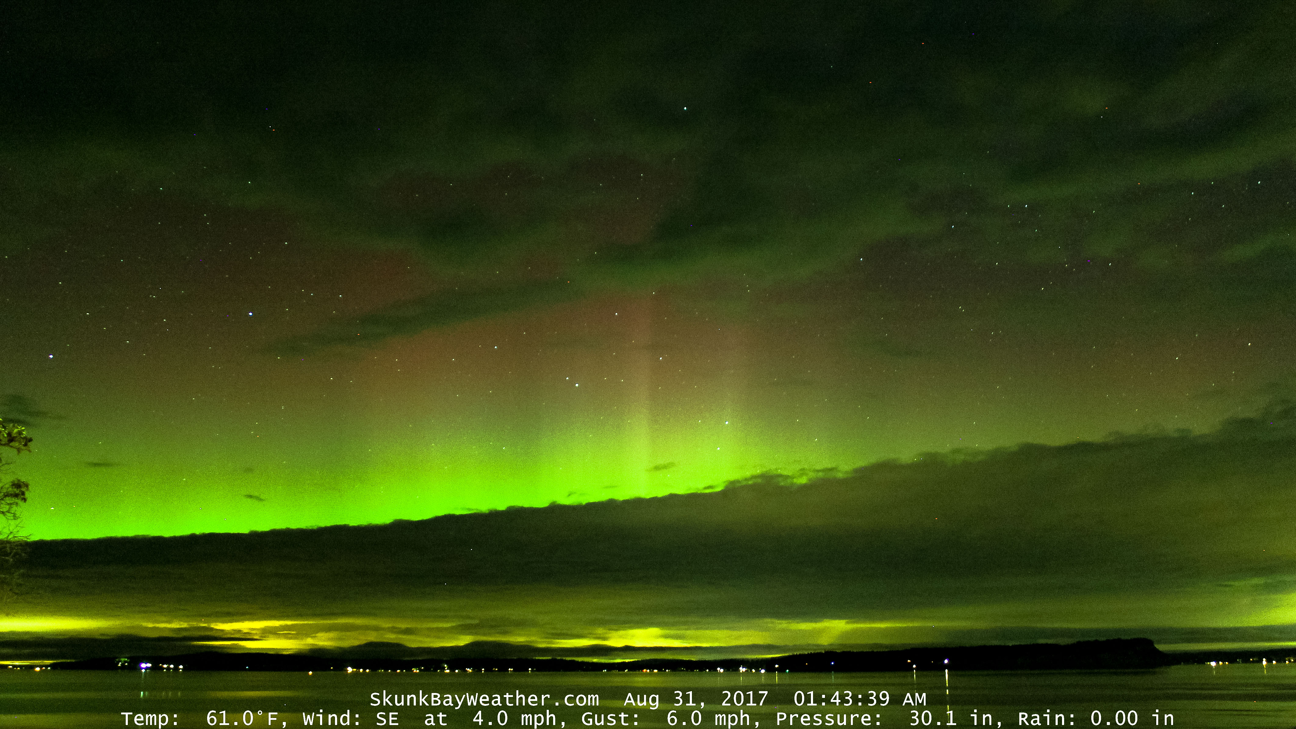 |